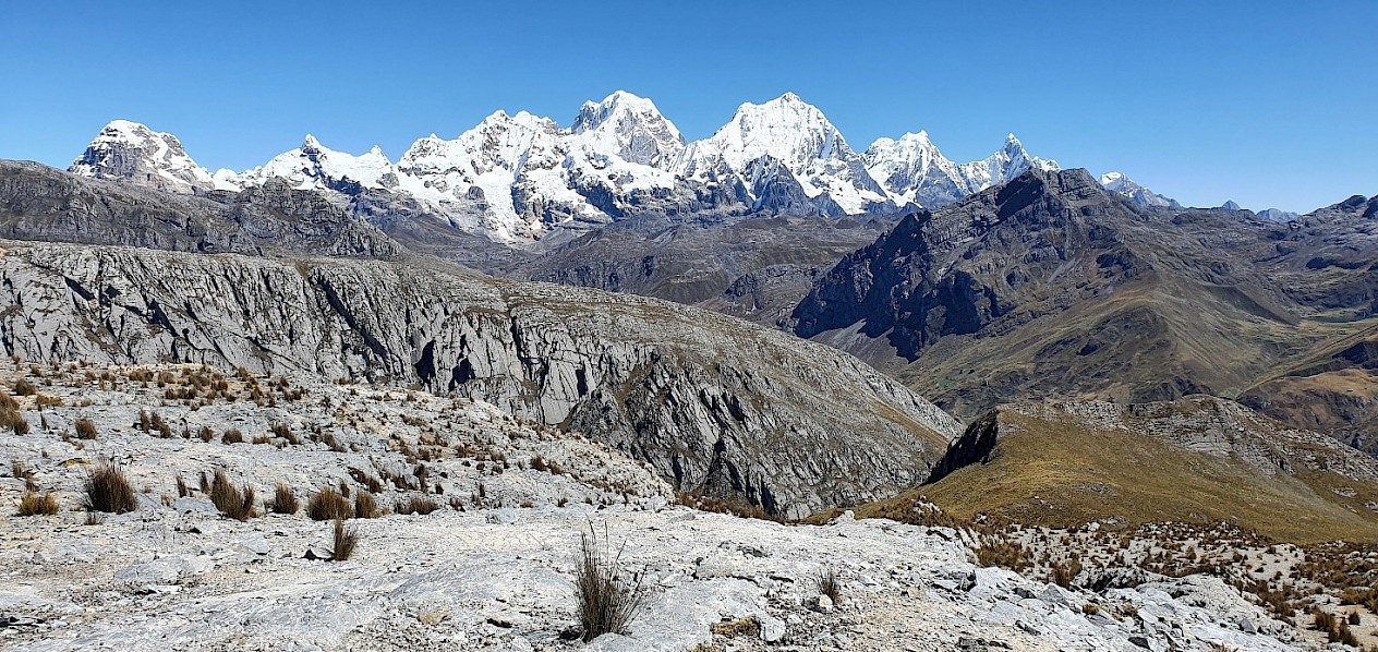
View from Tinka’s Silvia project towards the Huayhuash cordillera of central Peru
Introduction
The Silvia Project is 100% owned by Tinka following the acquisition from BHP Peru in July 2021. The project consists of 29,500 hectares of contiguous mining concessions held by Tinka’s 100% owned Peruvian subsidiary, Darwin Peru SAC. The project lies in the Huanuco region of central Peru immediately adjacent to the Tinka’s flagship Ayawilca zinc-silver project. Tinka is now one of the largest mining concession holders in this world-class mining belt of the central Peruvian Andes (see Figure 1).
The Silvia Project hosts exploration targets which are believed to be highly prospective for large copper-gold skarn and porphyry copper deposits. The project lies ~80 km south and along strike of Antamina, one of the largest copper mines in Peru and the world’s biggest skarn deposit (beneficially owned by BHP Group 33.75%, Glencore 33.75%, Teck 22.5% and Mitsubishi 10%). The project also lies close to the mines of Raura (zinc-silver-lead-copper) and Uchucchacua (silver-zinc-lead) (see Figure 1).
Limestone belonging to the Jumasha Formation, the main host to the Antamina copper-zinc-silver skarn deposit, is widespread throughout the Silvia Project area (see Figure 2).
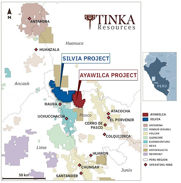
Figure 1. Mines of central Peru highlighting Tinka’s mining concessions at Ayawilca and Silvia projects
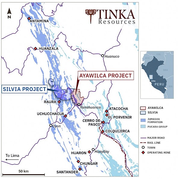
Figure 2. Map of limestone formations and major mines of central Peru
Copper-gold targets
The Silvia Project hosts two priority copper targets with outcropping skarn and coincident copper and geophysical anomalies (see Figure 3).
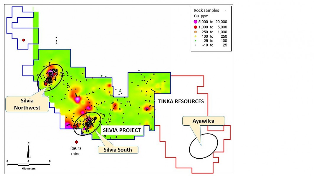
Figure 3. Silvia Project rock chip copper geochemistry on airborne magnetics (analytic signal)
Silvia Northwest target
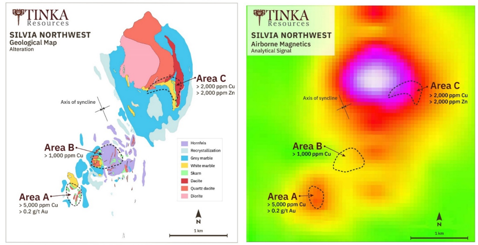
At Silvia Northwest, three areas of outcropping copper mineralization occur along a northeast-southwest trend encompassing a broad area of approximately 3.0 km by 1.0 km, each area referred to as Areas A, B, and C respectively (see Figure 4). Copper mineralization is associated with skarn alteration of Upper Cretaceous Jumasha Formation limestone and various intrusive and sub-volcanic rocks including diorite and dacitic porphyry. Coincident magnetic anomalies are interpreted to reflect the underlying intrusive rocks and, possibly, magnetite or pyrrhotite associated with the mineralization. Results of previous exploration can be summarised as follows:
At Area A, copper-bearing skarn mineralization occurs over a surface area of approximately 0.4 km by 0.2 km associated with altered dacitic porphyry. The skarn consists mostly of garnet and pyroxene accompanied by chlorite, biotite, quartz and magnetite. Sulphide minerals include chalcopyrite, pyrite, pyrrhotite, chalcocite and rare bornite. Copper oxide (malachite) is common. Copper values from 13 rock chip samples of skarn and altered porphyry at Area A range from 0.02% to 1.90% Cu; gold values range from <0.005 to 0.93 g/t Au; and zinc values range from 0.003 to 3.85% Zn. Extensive outcrops of white and grey marble are interpreted to form a halo around and above a buried skarn.
At Area B, skarn alteration outcrops sporadically over an area of approximately 0.7 km by 0.7 km associated with quartz diorite and porphyritic andesite dikes. Extensive areas of white and grey marble surround the intrusive and skarn rocks. Fine grained hornfels alteration interpreted to be caused by thermal metamorphism is associated with silty limestone of the younger Celendin Formation in the axis of a synclinal fold. Copper values from 28 rock chip samples of skarn at Target B range from 0.02% to 1.09% Cu; gold values range from <0.005 to 0.63 g/t Au; and zinc values range from <0.01 to 0.54% Zn.
At Area C, copper-bearing skarn occurs in sporadic outcrops over a surface area of approximately 0.5 km by 0.3 km together with outcrops of diorite and dacitic porphyry. Garnet skarn has been mapped around the contact of dacitic porphyry surrounded by a wide area of white and grey marble. Copper values from 13 rock chip samples from outcrop of skarn at Target C range from <0.01% to 1.10% Cu; Gold values range from <0.005 to 3.55 g/t Au; Zinc values range from <0.01 to 3.55% Zn.
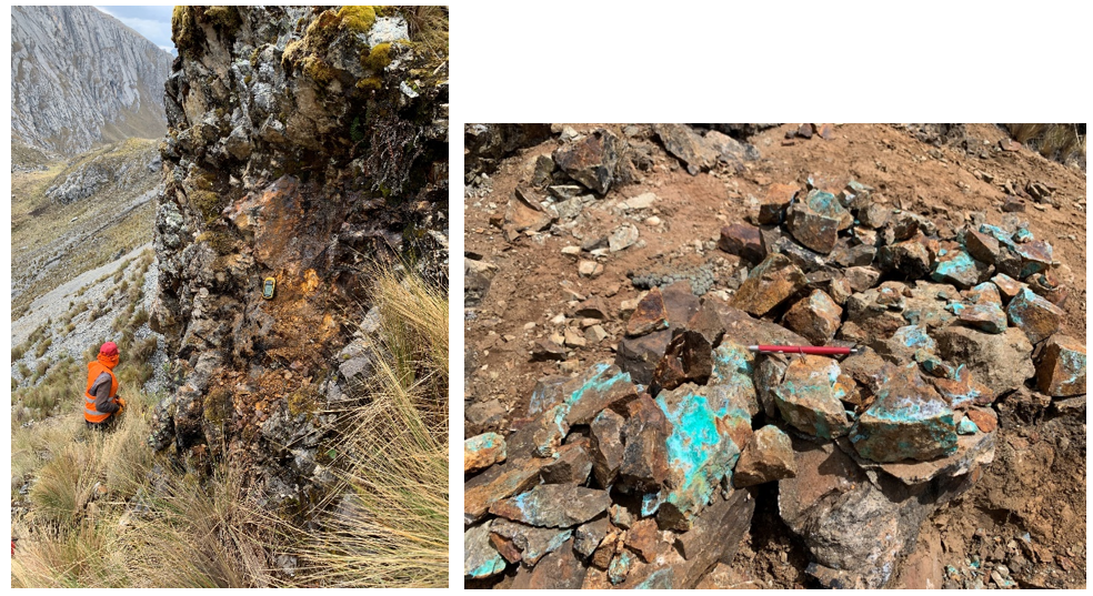 (A) Photos of skarn outcrops at Area A: (B) copper minerals at surface at Area A.
Silvia South target
At Silvia South, skarn alteration is exposed in numerous sporadic outcrops along a northeast-southwest trend within an area of approximately 3.7 km x 0.8 km associated with outcropping diorite and monzodiorite porphyry. Garnet and pyroxene skarns are associated with minor sulphides (pyrite, chalcopyrite) and sporadic malachite.
A previous explorer’s geochemical data includes 23 samples of skarn outcrops at Silvia South with copper values ranging from <0.01 to 1.37% Cu; gold values range from <0.005 to 0.28 g/t Au; and zinc values range from 0.03 to 0.06% Zn.